Looking back, I see that I have re-posted this entry almost every year since 2003.
Since the fires are burning again, though, I present you with these resources for information on the extent and location of the fires.
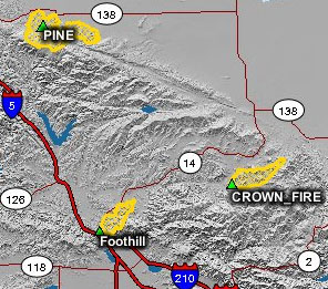
Geomac Wildland Fire Support Wildfire Viewer
California Wildfire Information - California Wildfire Alliance
MODIS Active Fire Mapping Program from Remote Sensing Applications Center.
Since the fires are burning again, though, I present you with these resources for information on the extent and location of the fires.
Geomac Wildland Fire Support Wildfire Viewer
California Wildfire Information - California Wildfire Alliance
MODIS Active Fire Mapping Program from Remote Sensing Applications Center.
Comments